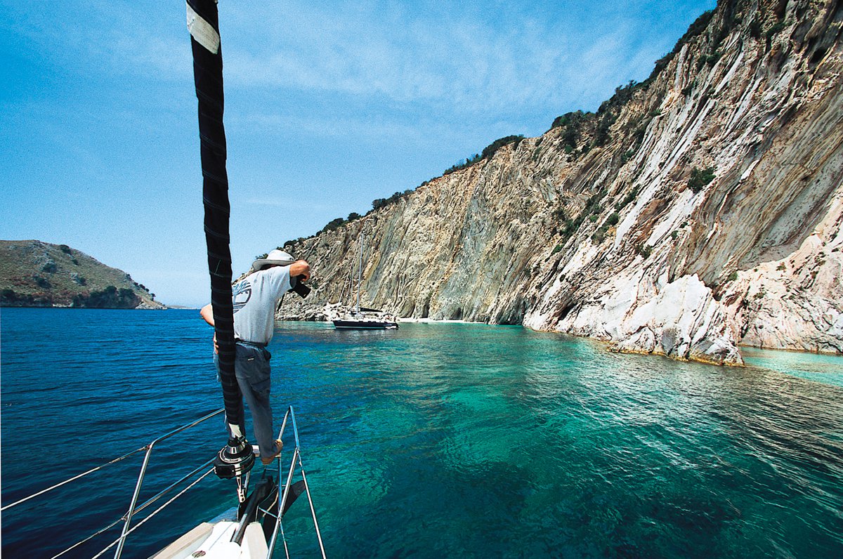
The sea area between Lefkada, Ithaki and the opposite mainland coast is considered by experts ideal for boat rides and sailing. This is due to the safe navigation it provides, as there is no extreme weather, and the great variety of sheltered moorings in picturesque bays, harbours and quiet beaches on many scattered islands.
The inhabited islands are Meganisi, which is also the biggest one, along with Kálamos and Kastós. Madourí, Scorpiós and Átokos are privately owned. The rest of the islands are very small and uninhabited: Spárti, Thiliá, Kíthros, Prováti, Formíkoula, the Echinades island complex, Arkoúdi, Vrómona, Mákri, Kounéli and so on.
Starting point for all sailing expeditions is the town of Lefkada, on one hand due to the area’s general interest, and on the other, because it boasts of one of the most modern marinas in Greece.
As an alternative, you can start sailing from the marinas of Preveza and Paléros, which as Lefkada, are served by Aktion airport, as well as by the port of Igoumenitsa which is the second gate of entry to the country from abroad.
Starting to cruise from Lefkada
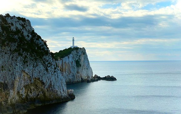
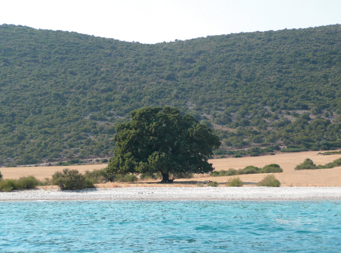
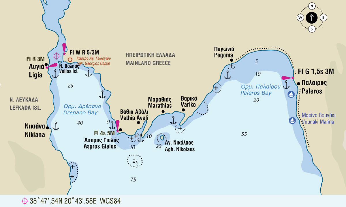
We sail through the channel of Lefkada heading south and paying attention to the buoys on the other side. At the end of the channel, on our left, we see Voliós skerry while on the hill at the opposite mainland coast is the Castle of Aghios Georgios. Before heading south to other harbours of Lefkada or to its small islands, it is worth making a stop at the interesting bays and beaches on the opposite mainland coast, such as Aspros Gialos and Marathias (one tree bay), as well as Varko beach.
Then, sailing offshore and with the help of thermal wind, we choose to anchor in some bay of Meganisi.
Navigation Dangers
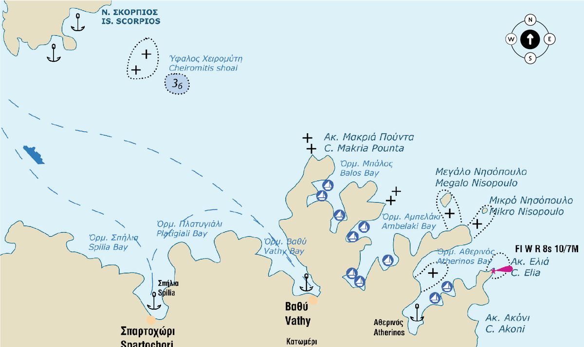
Waters in this region are generally quite deep, even at a short distance off the islands’ shoreline. Dangers: The Cheiromitis Shoal, near the imaginary line connecting the southwestern edge of Skorpios Island to the northernmost tip of Meganisi Island. Usually flotillas set up rough seamarks, but this is not guaranteed. Be extremely careful because this reef “emerges” suddenly and depth sounders are not helping. The indication just before reaching it is 50 m. of depth. The reefs close off the cape N. of Atherinos Bay at Meganisi, as well as in Atherinos Bay itself; finally, the reefs E. of Kálamos Island, in the channel between the island and the mainland of Aetolia-Acarnania and very close to the mainland’s coastline.
About the winds
A special feature of the area is the thermal wind which is really felt in Ahi Giannis in Lefkada and it constitutes one of the most popular meeting points for kite and wind surfers. This wind starts to blow in the early afternoon heading west-northwest and coincides with northwest winds. The phenomenon develops during the afternoon and disappears with the sunset. However, when this wind coincides with a true wind blowing at the same direction (northwest wind), then, the phenomenon continues throughout the night and usually lasts 2-3 days. This weather event takes place twice a month and the wind is usually cold.
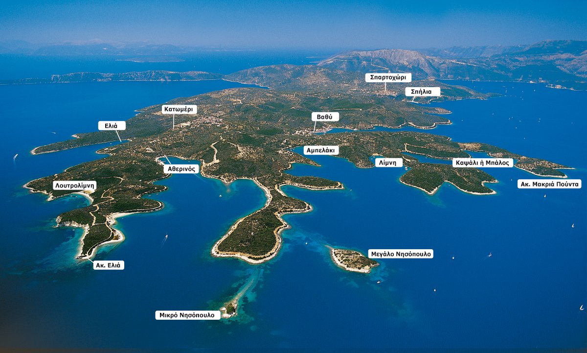
The islands of Lefkada - Meganisi
The harbours of the island are very beautiful and for this reason, very popular. Most of the island’s anchorages are on the northern coast, while there are quite a few on the east coast as well. The south coast is rocky and steep, with very deep waters, something that makes it unsuitable for anchorage. The west coast is particularly exposed to northwest winds that blow in the afternoon; however, you can anchor at the beaches near Thiliá island, and also at the north-western end opposite Kithrós islet with its interesting beach named “Beretta”.
The small bays which are protected from all sides at the northeast, are ideal and from there you can visit the island’s villages on foot. In Spartohori, Vathy and Katomeri you will find all you need. You just need to be careful only when entering the small harbour of Atherinós, of the reef on the right as you come in.
The unique petrol station of the island is in Spartohori (Fotis Soldatos, tel. 26450 51040, 6973373297) and it supplies boats at all the harbours.
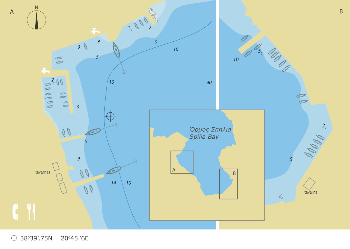
Spilia
Approach
It is situated at the northwest side of Meganisi, opposite the islet of Skorpiós. Its distinctive feature is Spartohori village which can be seen from afar, on the hill surmounting the harbour.
Mooring
The harbour is sheltered from the winds, although it’s slightly touched by strong northwest ones. There are three mooring possibilities:
A. On the eastern side of the bay, on the concrete pier behind the F/B ramp. This is the most protected place. The sea bed provides secure hold. If there is space, you can moor stern-to or sideways on the outer side of the small mole forming a small harbour for fishing boats with a 2 m. draught.
B. On the southern side of the bay, on the two wooden piers where in front of the tavernas “Asteria” and “Porto Speliá”.
C. On the concrete pier on the western side or in front of the tavern bow-to. Vessels with a draught of less than 1.8 m. can moor at the west of the beach.
Useful information
You will find food, water and telephone at the four seaside tavernas. Water is obtainable at the west mole. For a walk with a magnificent view, you can go up the stairs which after a while meet the road to Spartohori.
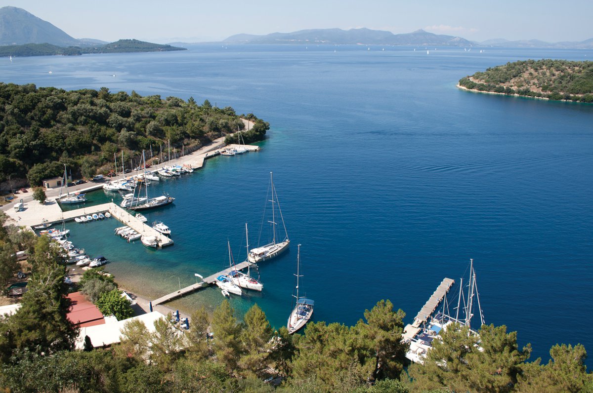
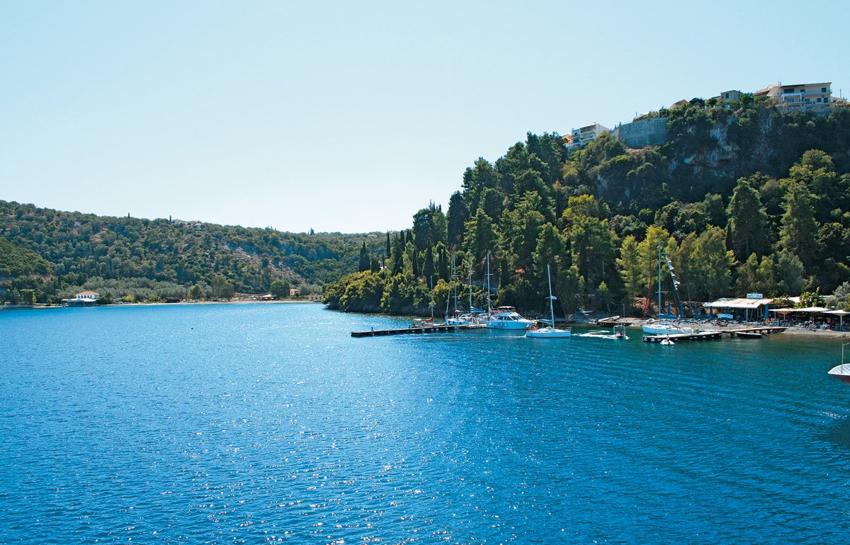
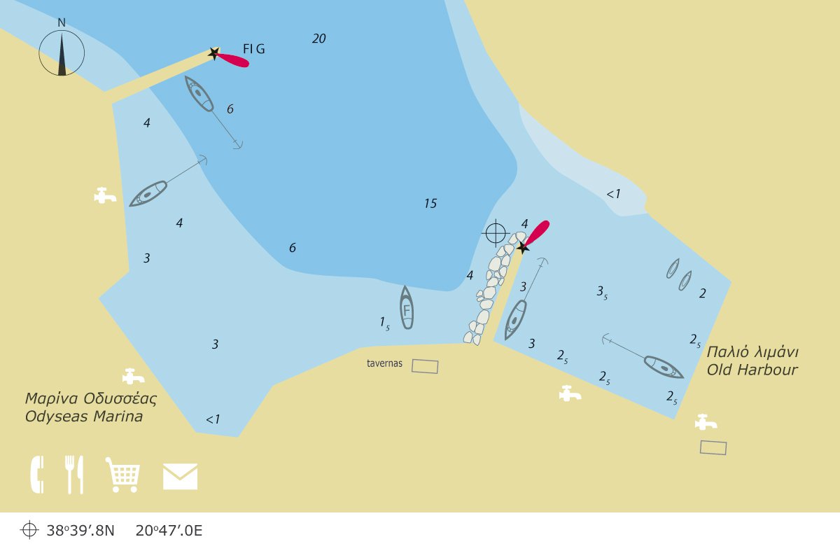
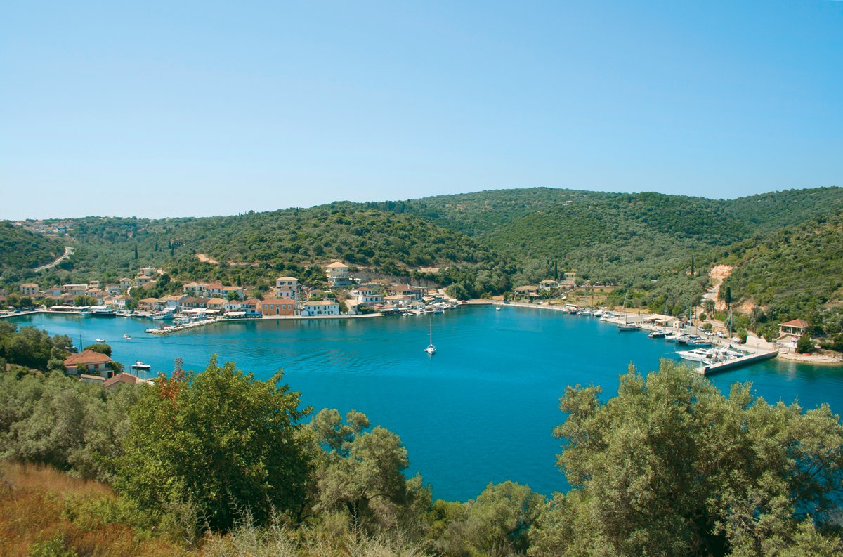
Vathy
It is situated on the north coast and it is the main harbour of Meganisi. It’s protected from all sides, but strong north or northwest winds may affect vessels which have anchored at the south end of the harbour. In July and August, despite the quite recent extensions and the improvements, the harbour gets full, so if you want to find a place, you should arrive there quite early.
Approach
The harbour and the village can be seen only at the entrance to the bay. A distinctive feature for those sailing from the southeast side, the cape Makriá Pounta, which is the northernmost end of Meganisi. The entrance to the harbour is about half a nautical mile to the west of the cape. Those who sail from Lefkada should be cautious of Cheiromitis Shoal, which is situated under Skorpiós island, about 1 nm north of the harbour’s entrance.
Mooring
You can moor stern-to or sideways on the west and south side of the harbour. The depths are greater than 2 m., with greater depths at the west side, which is suitable for bigger vessels. Only exception, the south-eastern part, with depths below 1.5 m.
Useful information
Here, you can make all the necessary provisions. Water is obtainable at the mole and there are tavernas, bars, a bakery and two mini-markets. You can walk up to Katomeri village on the hill surmounting Vathy, or by the beach to the bays of Kapsáli and Atherinós, situated to the east.